Alameda County Watershed Map
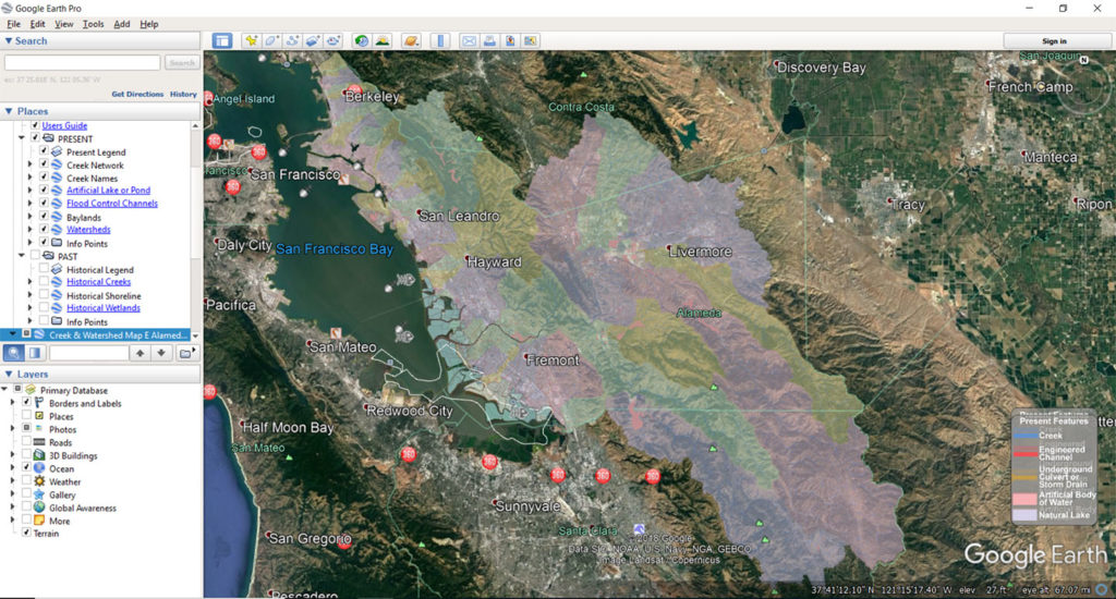
The Alameda County Watershed Map is a project of the Alameda County Flood Control and Water Conservation District, in collaboration with the San Francisco Public Utilities Commission, Fugro Consultants, and the Alameda County Resource Conservation District, and is an interactive, online map of every watershed in Alameda County that lets professionals, educators and outdoor enthusiasts explore and learn more by downloading KMZ watershed map files to your personal Google Earth Pro. These interactive maps let you compare the historical and present day watershed features, zoom in on creeks and follow them to the Bay, and learn more about restoration projects and other features and points of interest.
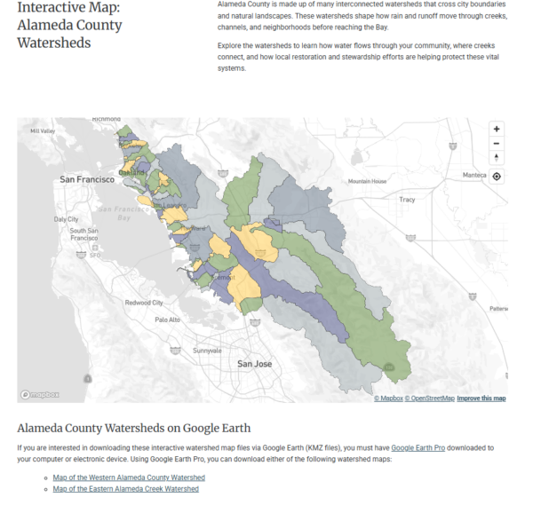
In addition to the Google Earth Pro watershed map, you can use the ACFC&WCD Explore Watersheds website to learn more about the hydrology, geology, and wildlife found in our local watersheds. From Berkeley to Fremont to Livermore, the online map has interactive, clickable watersheds with a quick overview and printable maps. “Learn More” pages for each watershed include an overview of the watershed, features, creeks and waterbodies, flora, fauna, hydrology and geology, subwatersheds, restoration efforts, recreation opportunities, ways to get involved and more.
")
Download the Maps and Explore Using Google Earth Pro
Please note that the ACFC&WCD has recently updated the KMZ files to ensure that they link to the watershed information on their website. If you previously uploaded the KMZ files to your Google Earth Pro, delete the old files and re-download them using the links above.
Primary Contact
Partners
- Alameda County Flood Control and Water Conservation District
- San Francisco Public Utilities Commission
- Fugro Consultants
Links